Deviation Actions


Description
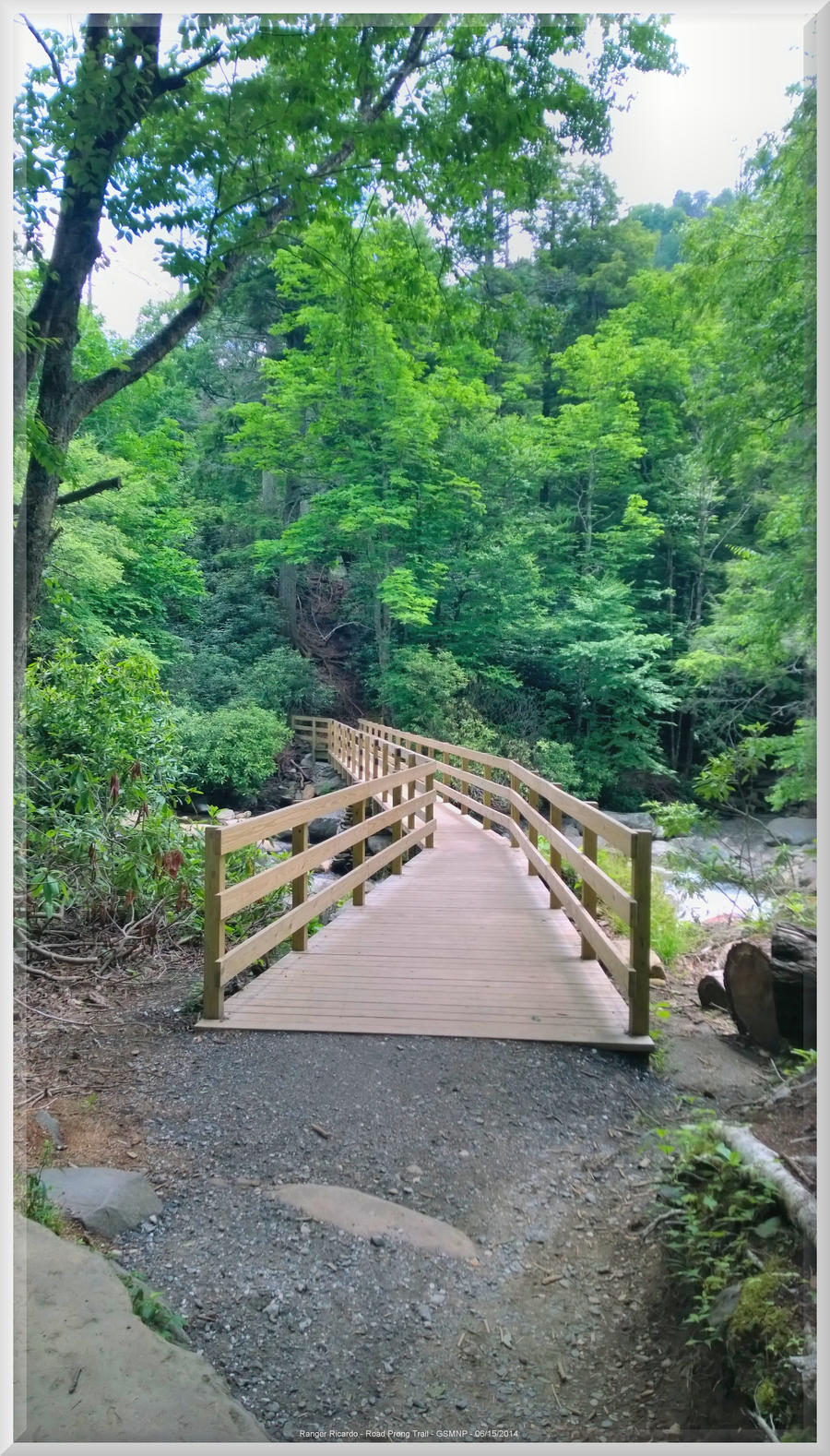
Road Prong Trail
3.4 miles from Newfound Gap Road to the AT at Indian Gap
Great Smoky Mountains National Park
Near Clingman's Dome in Swain County, North Carolina
Highlights include wildflowers and waterfalls
Cautions include creek crossings on steep narrow trail
Elevation low is 2200 feet above sea level
Elevation high is 5600 feet above sea level
Difficulty rating is moderate to strenuous
Condition of trail is good in beginning and deteriorates as you go up
The Alcoa Ridge Runners took this hike as a round trip of 6.8 miles starting and ending at Clingman's Dome Road on the fifteenth day of June in 2014. The tour would be for checking the progress of trail renovation and doing some rock hopping up the creek. Images of the trail, woods and waterfalls would be taken. On the team were the three leaders, Red, Blue and Yellow.
During the summer of 2010, storms caused flooding which washed out the bridge at the beginning of the Chimney Tops Trail. This bridge is over 70 feet long, spanning the Road Prong of the Little Pigeon River. One of the legacies of the illustrious Superintendent Dale Ditmanson was replacing the old structure with the new and improved causeway shown here which could stand the test of time and Smoky Mountain weather.